


the best hiking and walking Tracks + trails – Absoloot's Top Picks
Whether you’re after a leisurely lakeside stroll or an epic alpine adventure, Queenstown has a trail for you. At Absoloot, We’ve handpicked our favourite walks and hikes for all fitness levels, so you can experience the region’s stunning scenery at your own pace. From easy scenic routes to challenging summit treks, there’s no better way to explore the breathtaking landscapes right on our doorstep! Read below checkout our AllTrails profile HERE to check out our faves there!
1. Earnslaw Burn Track
Distance: 25.3km Return
Time: 1-2 days
Level: Challenging
If you’re looking for a true backcountry adventure, the Earnslaw Burn Track is an unforgettable journey through alpine meadows, river and marsh crossings, and stunning glacier views. This challenging hike takes you deep into the heart of Mount Earnslaw’s rugged landscape, leading to an ABSOLOOTLY breathtaking valley where waterfalls cascade from the hanging glacier above. It’s a spectacular spot for an overnight camp, with dramatic scenery straight out of a movie.
Fitness & Experience Level: This is a challenging hike, best suited for experienced trampers with good fitness. The track is unmarked in places, sometimes requiring river crossings, and can sometimes take around 8-10 hours one way, making it ideal for a two day trek. Proper gear and navigation skills are essential. One of the best New Zealand has to offer.
Getting There & Costs: The Earnslaw Burn Track starts near Glenorchy, about 1 hour’s drive from Queenstown. The trailhead is located on Lovers Leap Road, off Glenorchy-Paradise Road.
- Driving: A 4WD vehicle is highly recommended as the gravel road can be rough, especially after rain. If driving a rental car, check your rental company’s policy on unsealed roads.
- Transport Options: There are no public transport services to the trailhead. If you don’t have access to a 4WD, you may need to book a shuttle or guided tour from Queenstown.
- Parking: Limited roadside parking is available at the trailhead.

Image from queenstownnz.co.nz

Image from www.alltrails.com
2. Frankton Arm Walkway (Frankton Track)
Distance: 9.7km Return
Time: 3-4hrs
Level: Easy
A scenic and leisurely lakeside walk, the Queenstown to Frankton Track is perfect for those wanting to soak in stunning views without venturing too far from town. Following the shores of Lake Wakatipu, this well-maintained trail offers breathtaking vistas of The Remarkables, Cecil Peak and Kelvin Heights, with plenty of spots to pause and enjoy the scenery. Whether you're walking, running, or cycling, this track is a fantastic way to experience Queenstown’s beauty at a relaxed pace.
Fitness & Experience Level: Easy – Suitable for all fitness levels, including families and casual walkers. The track is mostly flat and takes around 1.5 to 2 hours one way.
Getting There & Costs: The track runs between Queenstown and Frankton, with multiple access points along the route. The #1, 2 and 5 Orbus service connects Frankton Bus Hub to Queenstown for those using public transport to get back.

Image from queenstownnz.co.nz

Image from www.alltrails.com
3. Bob's Cove Track
Distance: 11km Return
Time: 3hrs
Level: Easy
A short but rewarding walk, Bob’s Cove Track is a hidden gem just a short drive from Queenstown. This easy trail winds lakeside through native bush to a stunning turquoise cove, where the water is so clear it’s hard to resist a dip. A gentle climb to a lookout rewards you with panoramic views over Lake Wakatipu and the surrounding mountains. Perfect for a quick escape into nature, this track is a must-do for those looking to experience breathtaking scenery without a long trek.
Fitness & Experience Level: Easy – Suitable for all fitness levels, including families. The walk takes around 3hrs return (about 11km) with a short but steep section to the lookout.
Getting There and Costs: The track starts 15 minutes from Queenstown on Glenorchy-Queenstown Road. There is a small car park at the trailhead. No public transport available, so you'll need a private vehicle or taxi.

Image from www.doc.govt.nz

Image from www.alltrails.com
4. New Chum Loop
Distance: 7.2km
Time: 2.5hrs
Level: Moderate
A quiet and lesser-known gem, the New Chum Track offers a peaceful escape into Arrowtown’s scenic backcountry. Winding through beautiful beech forest and tussock-covered hills, this track provides a mix of gentle climbs and rewarding viewpoints overlooking the Wakatipu Basin. It’s a great option for those wanting a short but satisfying walk away from the busier trails, with plenty of birdlife and stunning seasonal colors in autumn.
Fitness & Experience Level: Moderate – Suitable for walkers with a reasonable level of fitness. The track has some inclines and uneven terrain but is well-formed. Expect to take around 2.5 to do the loop.
Getting There and Costs: The track starts in Arrowtown, about 20 minutes from Queenstown. You can drive and park at Bush Creek Recreation Reserve, or take the Orbus Route 2 bus from Queenstown to Arrowtown, departing every hour.
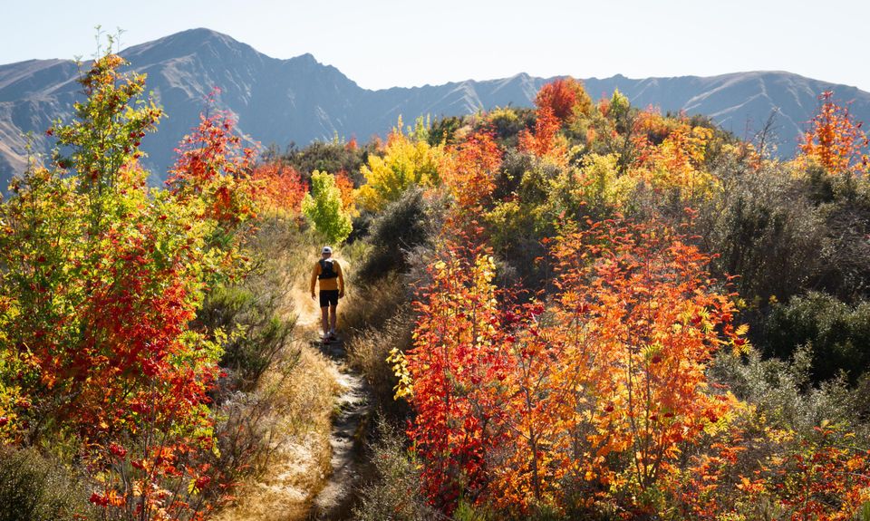
Image from www.wildthings.club

Image from www.alltrails.com
5. Lake Hayes Loop
Distance: 7.9km
Time: 2hrs
Level: Easy
One of the most picturesque walks in the Queenstown region, the Lake Hayes Loop offers stunning reflections of the surrounding mountains on calm days. This well-formed track circles the lake, passing through wetlands, open grasslands, and shady tree-lined sections. Along the way, you’ll enjoy breathtaking views of The Remarkables and Coronet Peak, making it a photographer’s dream. It’s a great spot for a peaceful stroll, a scenic run, or a leisurely bike ride.
Fitness & Experience Level: Easy – Suitable for all fitness levels. The loop takes around 2 to 3 hours to walk, with a few gentle inclines but no technical sections.
Getting There & Costs: The track starts 15 minutes from Queenstown, with parking available at multiple access points, including Lake Hayes Pavilion and the northern end near State Highway 6. Number 2 buses stop nearby Amisfield Winery, from Arrowtown or Queenstown. Free to access.

Image from www.queenstownnz.co.nz

Image from www.alltrails.com
6. Lower Wye Creek Track
Distance: 4km
Time: 3hrs
Level: Moderate to Hard
A rewarding climb with breathtaking views, the Wye Creek Track to the Helipad takes you high above Lake Wakatipu, offering panoramic vistas of the Remarkables and the vast alpine landscape beyond. The track follows a steady uphill climb through beech forest, past a beautiful waterfall, and eventually opens up to a narrow board walk above the mountainside. The helipad at the top is the perfect spot to take a break and soak in the stunning scenery before heading back down.
Fitness & Experience Level: Moderate to Hard – This track requires good fitness as it involves a steady and sometimes steep climb. This climb is not recommended to anybody with a fear of heights due to the boardwalk section of the trail. The return journey takes around 3 hours, with some uneven and rocky sections. Suitable for experienced hikers or those comfortable with sustained uphill walking.
Getting There: The track starts 20 minutes from Queenstown off State Highway 6 (Wye Creek turn-off). No public transport available, so you'll need a private vehicle or shuttle. Limited parking at the trailhead. Free to access.
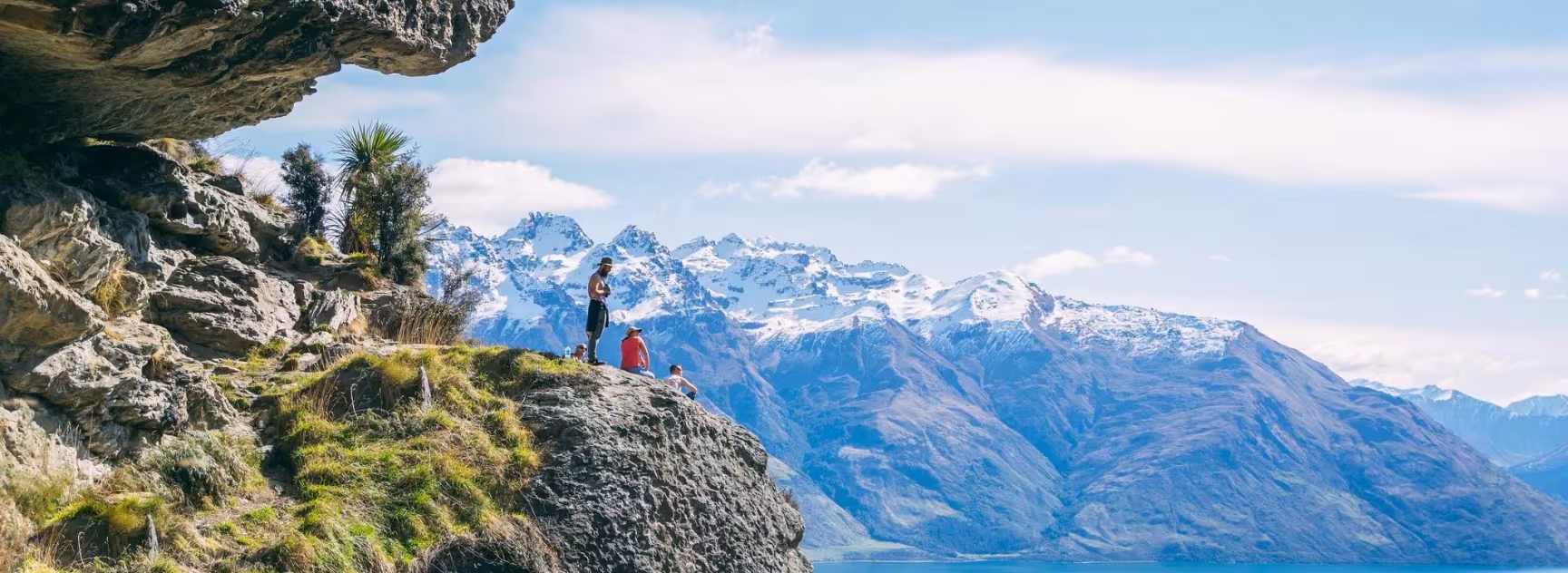
Image from www.queenstownnz.co.nz

Image from www.alltrails.com
7. Lake Alta
Distance: 3.4km
Time: 2hrs
Level: Moderate
A stunning alpine hike in the heart of The Remarkables, the Lake Alta Track takes you to a breathtaking glacial lake nestled among towering peaks. Starting near the Remarkables Ski Field base, this short but rewarding walk climbs through rugged alpine terrain, offering spectacular mountain views along the way. In summer, the lake’s crystal-clear waters reflect the surrounding peaks, making it a perfect spot for a picnic or even a refreshing dip if you’re brave enough!
Fitness & Experience Level: Moderate – While short (1.5–2 hours return, approx. 3.5 km), the track includes some steep and rocky sections, requiring a reasonable level of fitness. Suitable for most walkers, but sturdy footwear is recommended. In winter, the track may be snow-covered and require alpine experience.
Getting There & Costs: The track starts at The Remarkables Ski Field car park, accessible via a 13 km winding alpine road (Toll of around $15 per vehicle). In summer, the road is open to all but in winter, chains may be required.

Image from myqueenstowndiary.com

Image from www.alltrails.com
8. Moke Lake Loop
Distance: 6.9km
Time: 2hrs
Level: Easy to Moderate
Tucked away in a peaceful alpine valley, the Moke Lake Loop Track is a stunning walk that circles the shores of this serene, mirror-like lake. Surrounded by rolling hills and rugged peaks, the track offers breathtaking scenery and plenty of opportunities for photography, birdwatching, or even a refreshing swim in summer. With its relatively gentle terrain, this is a fantastic walk for those looking to escape the crowds and enjoy Queenstown’s natural beauty in a tranquil setting.
Fitness & Experience Level: Easy to Moderate – Suitable for most walkers, with a 6.5 km loop that takes around 2 hours to complete. The track is well-formed with a few gentle inclines but no technical sections.
Getting There: Moke Lake is about 20 minutes from Queenstown via a gravel road, which is generally accessible by most vehicles in dry conditions. However, the road can become muddy and difficult after rain, so a 4WD is recommended in very wet weather. There is no fee to access the track.

Image from weseektravel.com

Image from www.alltrails.com
9. Fernhill Loop
Distance: 10km
Time: 4hrs
Level: Moderate to Hard
A fantastic half-day hike with rewarding views, the Fernhill Loop Track takes you through lush beech forest before opening up to breathtaking panoramas over Queenstown, Lake Wakatipu, and The Remarkables. This well-graded track offers a mix of steep climbs and more gradual sections, making it a great option for those looking for a solid workout with stunning scenery along the way. Please note that there are mountain bike tracks up there that cross the trail so try to keep on the right track.
Fitness & Experience Level: Moderate to Hard – This track has a steady uphill climb and some steep sections, requiring a good level of fitness. The full loop is about 10 km and takes 3–4 hours to complete. Some parts can be slippery after rain, so good footwear is recommended.
Getting There: The track starts from Fernhill, just outside central Queenstown, making it easily accessible on foot.

Image from authenticas.org

Image from www.alltrails.com
10. Arthurs Point via
Moonlight and Ben Lomond Tracks
Distance: 17.2km
Time: 6hrs
Level: Hard
For those seeking a true backcountry adventure, this route from Queenstown to Arthur’s Point via the Moonlight and Ben Lomond Tracks offers an incredible mix of alpine scenery, historic gold mining relics, and breathtaking mountain views. Starting from the Ben Lomond Track, you’ll climb through native bush to reach expansive tussock-covered ridges before descending into the remote Moonlight Valley. The track then follows the historic Moonlight Trail, once a key route for gold miners, eventually leading to Arthur’s Point.
Fitness & Experience Level: Hard – This is a long and challenging hike, requiring good fitness and good navigation skills. Expect steep climbs and rugged terrain. The full route is around 17 km and can take 6-7 hours one way. Suitable for experienced hikers only.
Getting There & Costs: You can start from central Queenstown via the Tiki Trail to Ben Lomond or take the Skyline Gondola (fee applies) to save time. The track finishes at Arthur’s Point, so you may need transport back to Queenstown. The number 2 Bus (Cash Only) stops every hour on the main road near Arthurs Point. There is no cost to access the track itself.

Image by instargam.com/chrismanuel

Image from www.alltrails.com
11. Queenstown Gardens Loop
Distance: 1.9km
Time: 30mins
Level: Easy
This easy loop is a scenic and relaxing walk through the beautiful Queenstown Gardens, located on the shores of Lake Wakatipu. The well-maintained path winds through a mix of native and exotic trees, with benches along the way to take in the stunning lake and mountain views. It’s a popular route for walking, running, and cycling, and offers fantastic photo opportunities, from reflections on the lake to the surrounding peaks.
Make sure to explore the rose garden, manicured lawns, and ponds in the garden’s center. The trail is open year-round, making it a great spot to visit in any season.
Fitness & Experience Level: Easy – Suitable for all ages and fitness levels. The loop takes about 20–30 minutes to complete on a flat, shared path.
Getting There & Costs: Located in central Queenstown, the gardens are easily accessible on foot. Entry is free, but nearby parking may have time limits or fees.

Image by queenstownnz.co.nz

Image from www.alltrails.com
12. Ben Lomond
Distance: 15km
Time: 6hrs
Level: Hard
One of Queenstown’s most iconic hikes, the Ben Lomond Track offers breathtaking 360-degree views from the summit, stretching over Lake Wakatipu, The Remarkables, and even Mount Aspiring on a clear day. The climb takes you from native beech forest up through alpine tussock, with a steady ascent leading to the Ben Lomond Saddle before the final push to the 1,748m summit. It’s a challenging but incredibly rewarding trek, perfect for those looking to experience Queenstown’s alpine beauty.
Fitness & Experience Level: Hard – This is a demanding full-day hike requiring good fitness and stamina. The return journey from Queenstown takes 6–7 hours (15 km return), with 1,438m of elevation gain. The track is steep and exposed in places, so sturdy footwear, plenty of water, and weather-appropriate clothing are essential. Snow and ice can be present in winter, requiring alpine experience.
Getting There & Costs: The track starts from central Queenstown, either via the Tiki Trail (near Skyline Gondola) or from the gondola’s upper station (taking the gondola saves about an hour of steep climbing, but a fee applies).
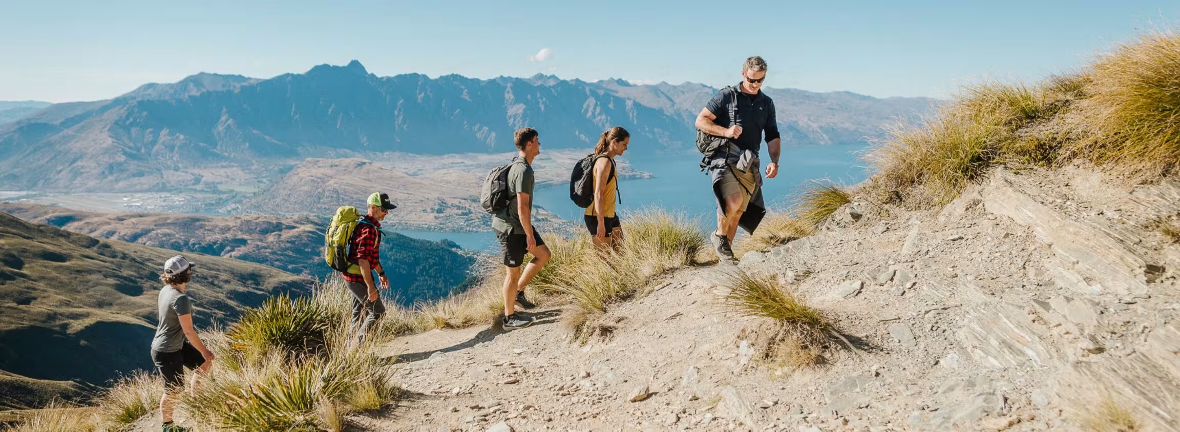
Image by queenstownnz.co.nz

Image from www.alltrails.com
13. Tiki Trail
Distance: 4.5km
Time: 2.5hrs
Level: Moderate to Hard
A steep but rewarding climb, the Tiki Trail is a great short hike that takes you from central Queenstown up to the Skyline Gondola complex, offering fantastic views over Lake Wakatipu, Queenstown, and The Remarkables. Winding through dense beech and pine forest, the track provides a shaded, peaceful escape from the town below. Once at the top, you can relax at the Skyline complex, grab a coffee, or continue your adventure up Ben Lomond.
Fitness & Experience Level: Moderate to Hard – Though short (2 km one way), the trail is steep and can be slippery in places, requiring a reasonable level of fitness. Expect the hike to take 45 minutes to 1 hour one way.
Getting There & Costs: The trail starts at the base of the Skyline Gondola in central Queenstown. There is no cost to hike the trail, but if you prefer, you can take the gondola up or down for a fee.

Image by queenstownnz.co.nz

Image from www.alltrails.com
14. Queenstown to Jack's Point
Distance: 23.3km
Time: 6 hours (One Way)
Level: Moderate
A stunning lakeside trail with breathtaking views of The Remarkables and Lake Wakatipu, the Queenstown to Jack’s Point Track is a must-do for keen hikers and mountain bikers. The track follows a mix of undulating hills, rugged coastline, and open tussock-covered landscapes, offering a true backcountry feel while staying close to town. With plenty of scenic rest spots along the way, this trail is a fantastic way to experience Queenstown’s natural beauty.
Fitness & Experience Level: Moderate – The full track is about 23 km one way and takes 6+ hours to walk, with some steep and exposed sections. A reasonable level of fitness is required, and good footwear is recommended due to uneven terrain. The track is also popular with mountain bikers, so be mindful of sharing the trail.
Getting There & Costs: The track starts from Frankton (near the Jardine Park entrance) or from Queenstown via the Frankton Track. The Jack’s Point end has parking available, but you’ll need to arrange transport back to Queenstown if you’re not returning on foot or by bike. The Orbus service operates Route 4 departing every 1hr from, connecting Jack's Point to the Frankton Hub where you will need to change to the number 1,2 or 5 bus back to town.

Image by queenstownnz.co.nz

Image from www.alltrails.com
15. Queenstown Hill
Distance: 5km
Time: 2.5 - 3 hours
Level: Moderate
Queenstown’s most popular short hike, the Queenstown Hill Track offers stunning panoramic views over Lake Wakatipu, The Remarkables, and the Kawarau River. The well-formed trail winds through a beautiful pine forest before opening up to rolling tussock-covered hills. Before the summit, you'll find the Basket of Dreams sculpture, a perfect spot to take in the breathtaking scenery and reflect on the area's natural beauty before making the final push for the summit.
Fitness & Experience Level: Moderate – The return walk is about 5 km and takes 2–3 hours, with a steady uphill climb of around 400m elevation gain. The trail is well-marked but can be steep in places, so a moderate level of fitness is recommended.
Getting There: The track starts at the Queenstown Hill Walking Track car park on Belfast Terrace, just a short drive or 15-minute walk from central Queenstown.
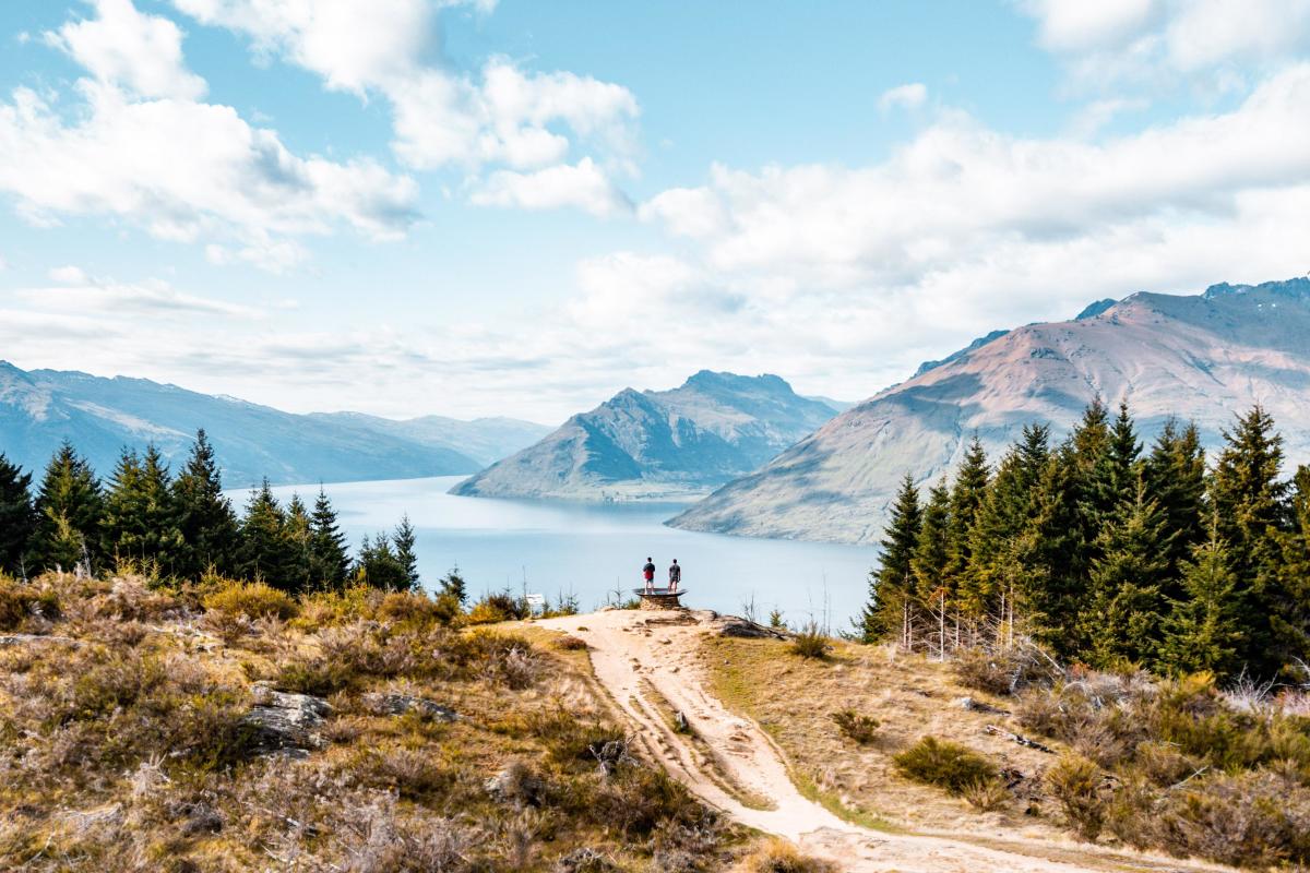
Image by queenstownnz.co.nz

Image from www.alltrails.com
16. Queenstown to Sunshine Bay
Distance: 7km
Time: 1.5 hours
Level: Moderate
A short and scenic lakeside walk, the Queenstown to Sunshine Bay Track is perfect for those looking to escape the town centre without venturing too far. This peaceful trail follows the shores of Lake Wakatipu, offering stunning views of the water and surrounding mountains. The track winds through native bush and features a few secluded spots to relax by the lake. At the end, you’ll reach Sunshine Bay, a small, quiet beach perfect for a rest, picnic, or even a swim in summer.
Fitness & Experience Level: Easy – The track is around 3.5 km one way and takes 30–45 minutes to walk at a relaxed pace. It is well-formed and mostly flat, with a few gentle inclines. Suitable for all fitness levels.
Getting There & Costs: The track starts at from central Queenstown. If returning from Sunshine Bay, you can either walk back the same way or catch the bus number 1 back to Queenstown
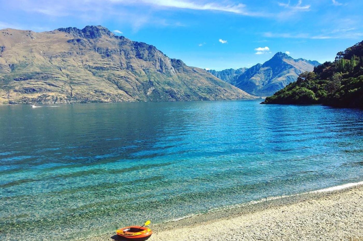
Image by @melissapenrose queenstownnz.co.nz

Image from www.alltrails.com
Useful Websites
Alltrails: www.alltrails.com
Department of Conservation: https://www.doc.govt.nz/
Wild Things: https://www.wildthings.club/trails/otago/
Metvuw Weather: https://www.metvuw.com/




#alwaysbookdirect